Brine Water Line Replacement
Project Location: Near Lindbergh, Alberta
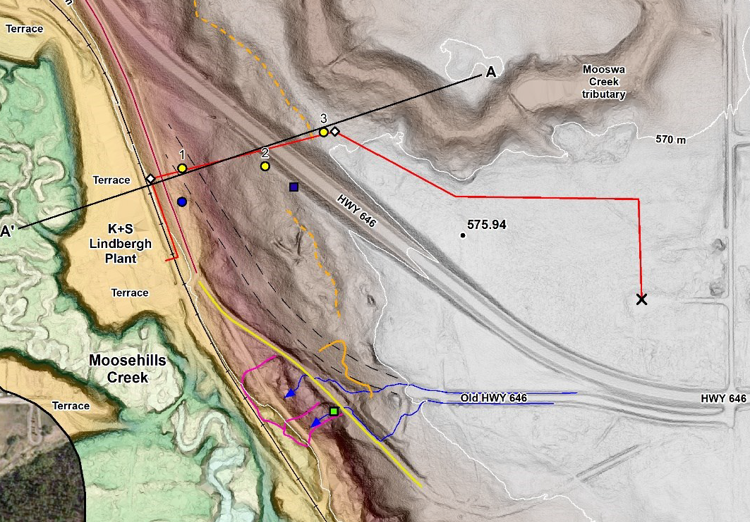
SolidEarth completed a geotechnical investigation for a proposed Horizontal Directional Drilling (HDD) near Lindbergh, Alberta, for a pipeline installation from the K+S Windsor Salt Mine Plant up the hill, crossing Highway 646 and into the uplands where an injection well is located. HDD method was proposed to install the pipeline between the toe and crest of the hill. The bore path trajectory was approximately 340 m long (horizontal distance), and approximately 40 m below the highway at its deepest location. An area near the proposed alignment had experienced slope instability in the past which affected an existing pipeline between the Plant and the disposal field.

SolidEarth completed a terrain analysis and geo-hazards evaluation. The evaluation was based on site reconnaissance, analysis of aerial LiDAR dataset, historical aerial photographs, and review of geology maps and borehole data.
SolidEarth also completed a geotechnical assessment, slope stability modeling, and engineering assessment of the bore path design and alignment. Engineering evaluation included recommendations for drill trajectory, soil parameters for bore design, potential of instability with the valley slope, and identification of No-drill zones.
